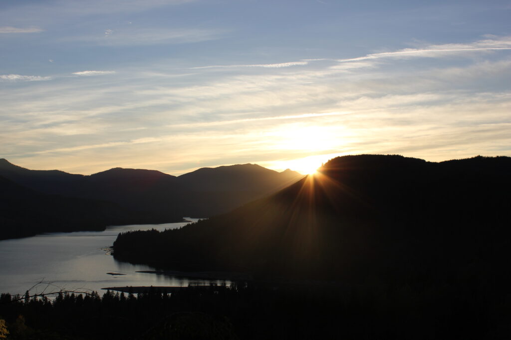
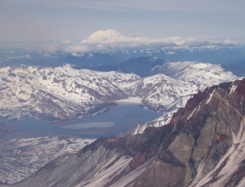
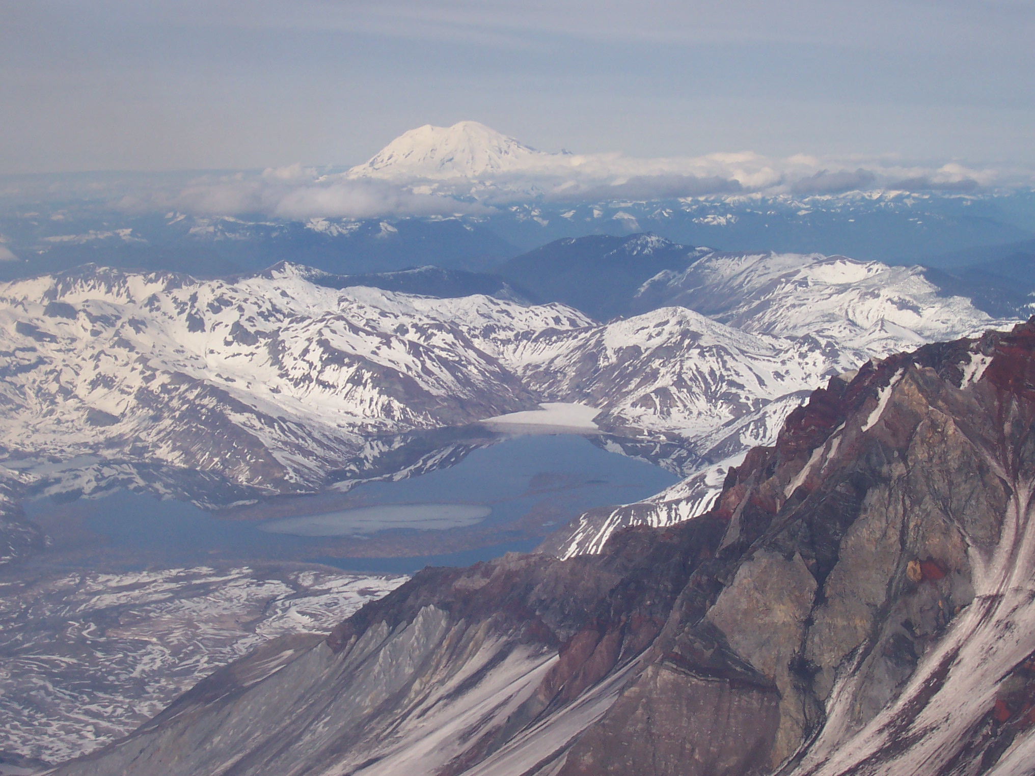
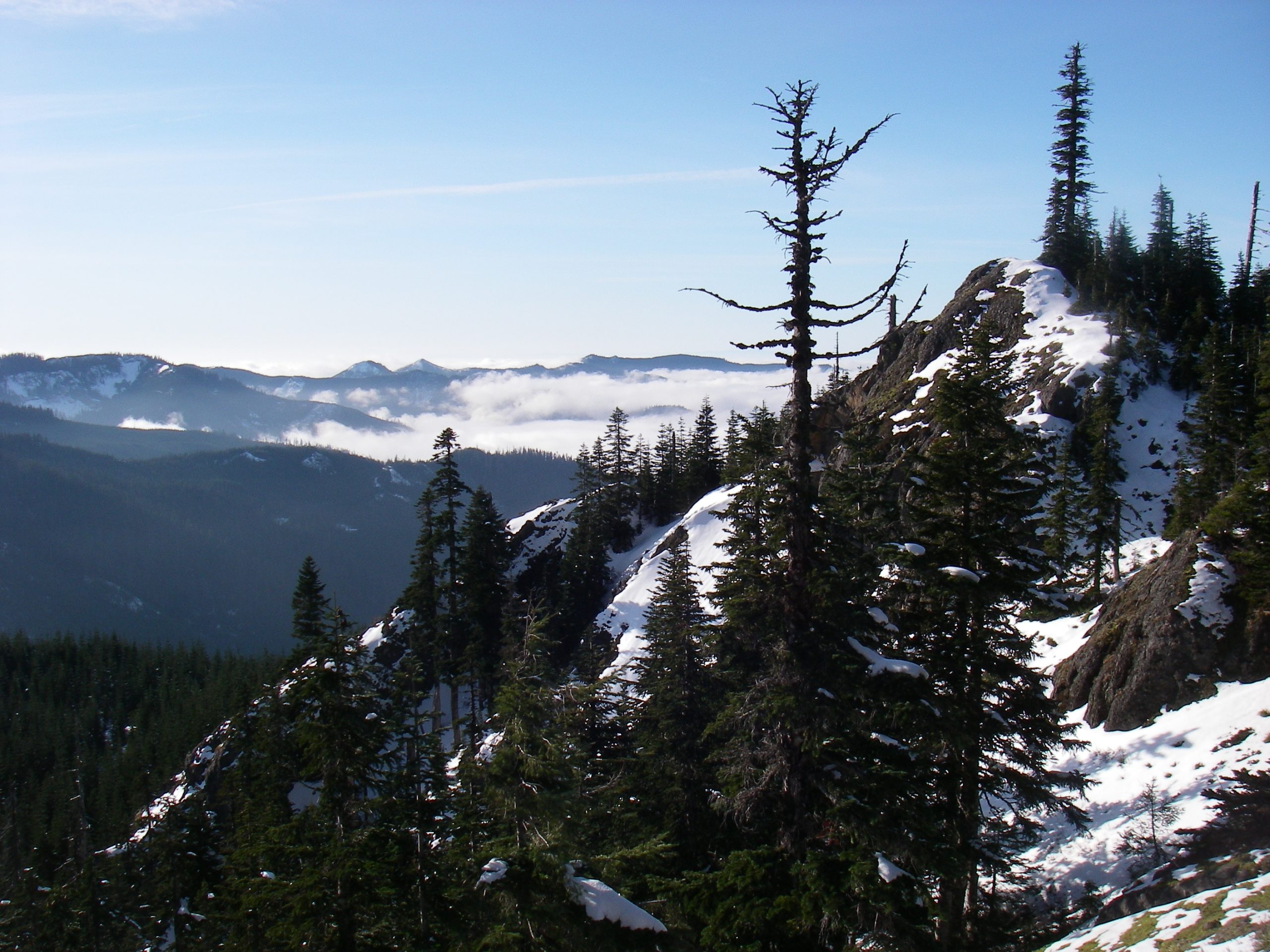
At Eagle Cliffs the Lewis River ends a journey. For thirty-five miles, the Lewis coursed and grew from its origins high on Mt. Adam’s north flank. Throughout its development from an infantile snow-stream to a full-sized, adult river, the Lewis fell over 6,200 feet, running natural, unobstructed, and free. Like a growing child, the Lewis enjoyed a playful, responsibility-free early life. That early life transitions at the Eagle Cliffs. The Eagle Cliffs and the deep water of the Swift Reservoir mark the Lewis’ transition to adulthood.
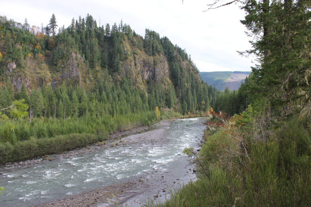
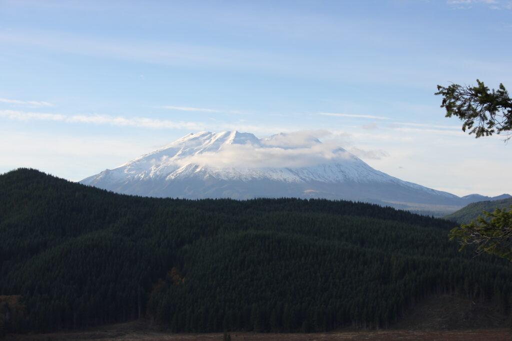
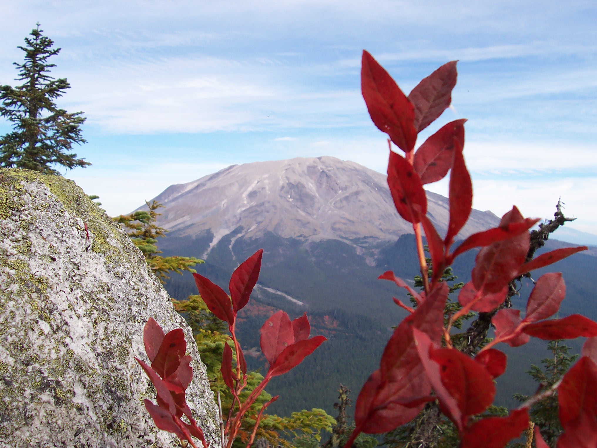
Downstream of the cliffs, the Lewis River works hard in a productive, power-producing career spanning three separate reservoirs. At Eagle Cliffs, however, that career is yet to come. Just upstream from the cliffs, Pine Creek and the Muddy River contribute two final pulses of water into the Lewis. This contribution is a farewell from two mountainous tributaries to a sibling river leaving the Alpine. Fittingly, both Pine Creek and the Muddy River originate high on Mt. St. Helen’s east flank. Their contribution comes at the end of the Lewis’ journey through snow fields, lava cliffs, dense forests, waterfalls, and around countless boulders.
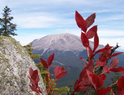
The Eagle Cliffs, at the eastern end of the Swift Reservoir, sit at the hub of Swift Reservoir recreation. The clifftops themselves provide a panorama of Mt. St. Helens to the north, the final rapids of the Lewis below, and the Swift Reservoir and the high peaks of the Siouxon to the west. They are a pleasant point from which to contemplate the Lewis. At the base of the cliffs sits Northwoods, a small community of privately owned cabins. Just west of the cliffs on Forest Road 90 is Swift Camp, an extensive car campground and public boat launch. Both Northwoods and Swift Camp come alive in the summer, swelling with families, retirees, and boaters who all seek the rejuvenation provided by the pleasantly relaxed lake life.


The Pine Creek Visitors Center sits just north of the Forest Service 90 road, close to the mouth of the Lewis. The visitors center dispenses tourist information about the Mt. St. Helens area, and serves as a base of operations for Forest Service maintenance personnel and interpreters. Providing a clean, polished volcano experience is the basic mission of these maintainers and interpreters. Given the huge influx of tourists into the Gifford Pinchot National Forest each summer, the Forest Service works hard to maintain both the mountain’s system of roads and campgrounds, and its series of interpretive signs, bathrooms, and viewpoints that all work to facilitate a convenient and pleasant car touring experience of the volcano. A small cadre of Forest Service Interpreters work hard all summer, moving through a grid of locations and time schedules, giving lectures about the mountain. These “interpts” are the face of the Forest Service; giving presentations about the 1980 eruption, the ensuing regeneration, how the Ape Caves formed, and a host of other topics, all while answering the myriad of common tourist questions about Mt. St. Helens.
With Northwoods, Swift Campground, and Pine Creek Visitors Center all making their appearance at Eagle Cliffs, there is no doubt that the young Lewis has met human civilization here. Upstream lies secluded forest and a high mountain; downstream lies reservoirs, farming history, levees, and a small navy of sport fisherman. For the Lewis, Eagle Cliffs are a place of transition.

