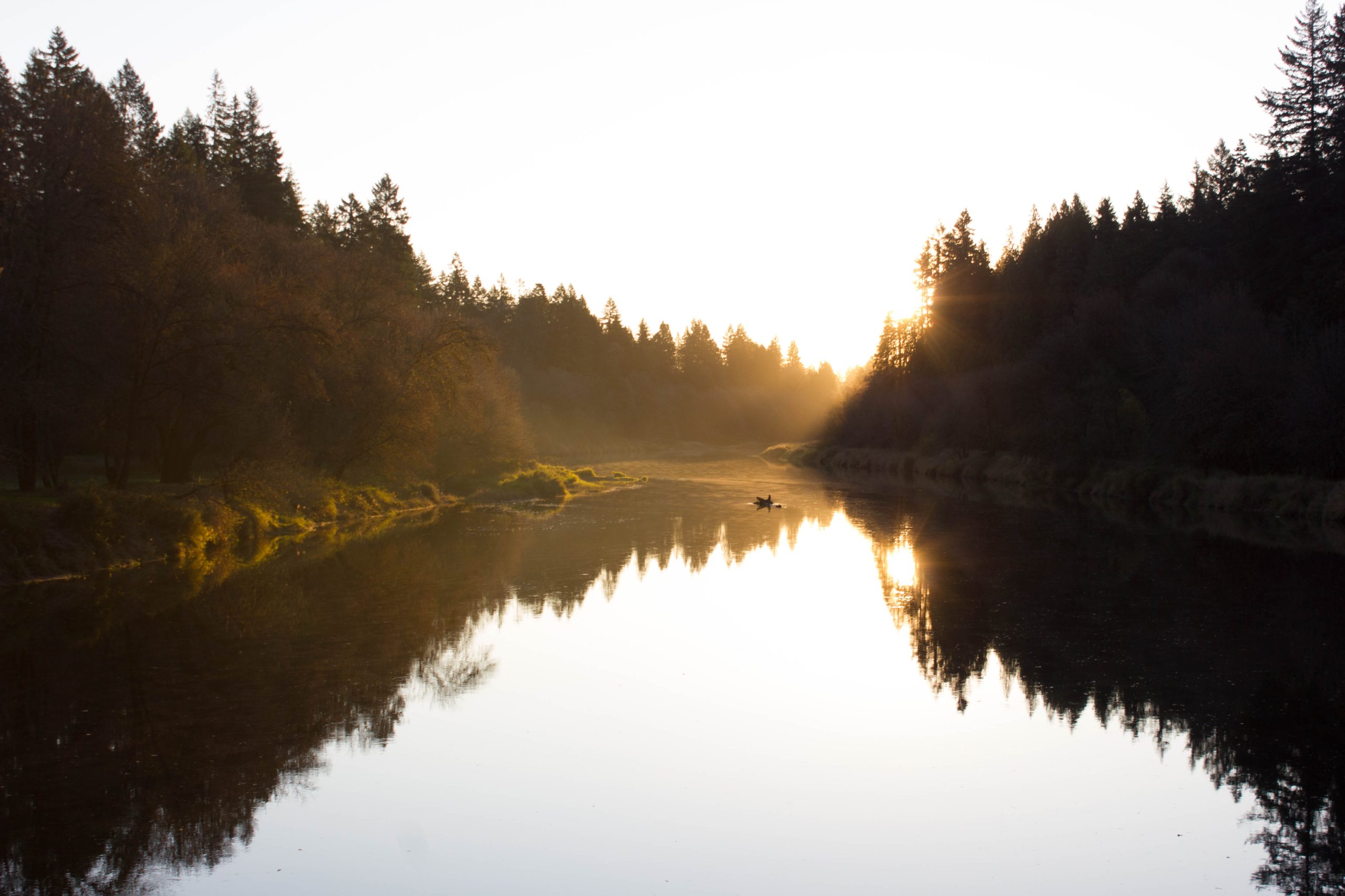

n autumn sunrise view along the Lewis.
A century ago, the East Fork Lewis River was central to life and commerce in north Clark County. It, like other rivers, served as a highway in the period before oil energy ushered in the age of easy mobility. In those days, long before Clark County’s population exploded into subdivisions, bedroom communities, and view homes, the farm and timber-driven economy relied heavily on waterways for transportation. Being such a fundamental part of local life, the features of the East Fork were as familiar to area residents as our supermarkets, websites, and roads are to us today. Those long-gone locals saw the river differently than we do today, with our modern, bridge-bound viewpoint. Ironically, we routinely drive over, and yet miss, a section of the East Fork that those before us knew well, a place they called Paradise.
Paradise Point lies one and a half miles upstream from Forks, the point where the Lewis’ North and East Forks become one. Two miles downstream from La Center, Paradise Point is a part of what used to be an aquatic highway, one which saw ample sternwheeler traffic. Before the days of paved roads and 18-wheelers, navigable waterways provided one of the only realistic means, absent a rail line, for moving large quantities of goods. Though they are in their final stages of returning to nature, one can still see the pilings of the old stern wheeler piers along the banks of lower East Fork. In those days, Paradise Point would have been a landmark for any who traveled the East Fork. With its recognizable rocky bluff and subsequent oxbow river bend, it signaled the last few hundred yards of the East Fork Lewis River.
Rocky cliffs, a small sandy beach, thick deciduous trees, calm water, meadows of green grass gently swaying in the summer breeze, sun on sparkling water; locals called this place Paradise long before an interstate freeway dominated the small rocky point. In 1958, Washington state began acquiring land parcels to create a park in this then-tranquil area. As the decades passed, however, the coming of I5 and the ever increasing traffic of an ever increasing population began to overpower the quiet river scene. What was once a peaceful place of restful camping and swimming became synonymous with a joke of a park that had morphed into a scene of crime, traffic noise, and poor facilities.
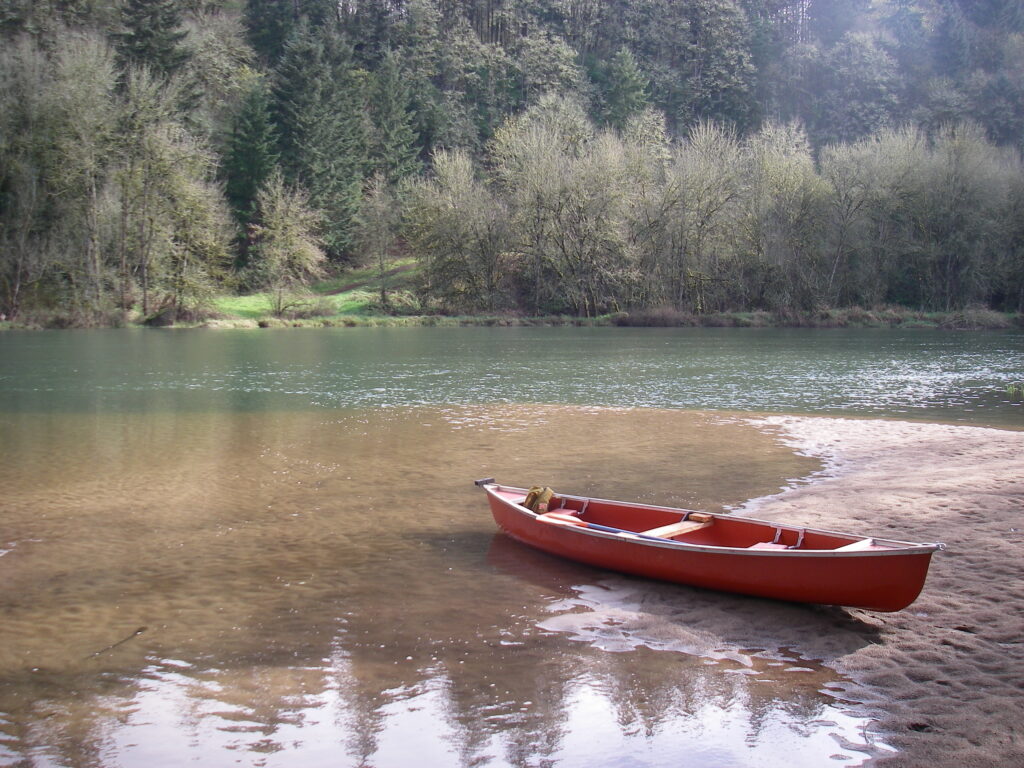
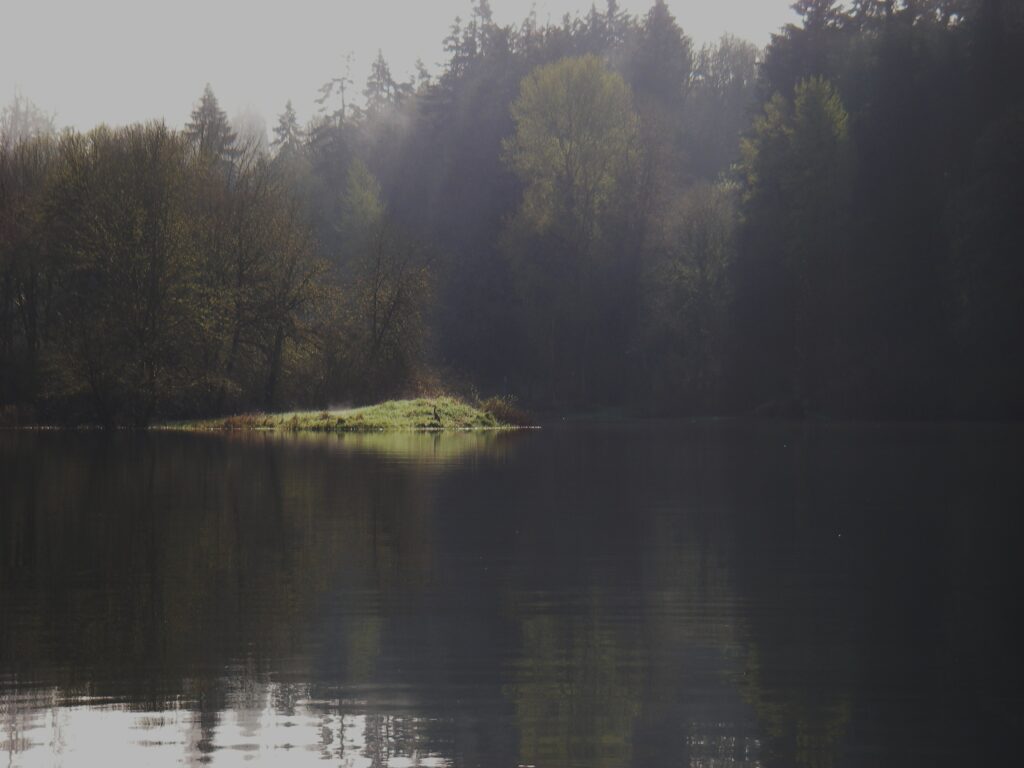
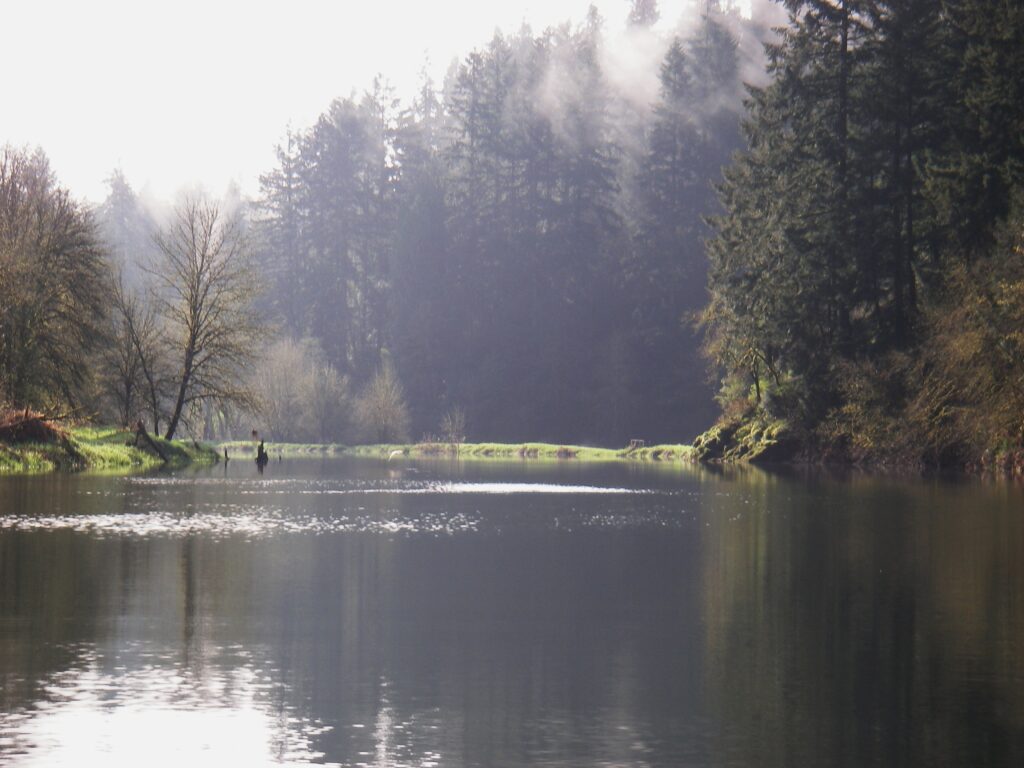
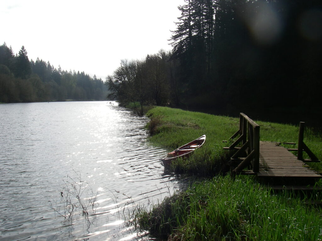
That has changed. Today, even with the interstate bridge still overhead, Paradise Point State Park is more than worth a visit. While there is overnight camping available, where the park shines is on the water. One can easily carry a canoe, kayak, or small raft from the parking area to the slow moving river. From the park beach, a fifteen minute paddle upstream earns the paddler a scene worthy of a travel brochure. Just upstream from the park, the East Fork widens and slows a bit. On your right (if heading up stream) is Paradise Point proper. The Point is a twenty foot rocky bluff with two faces. On face simply points towards the northern shore. The other face, though, is the jewel, the reason, in my opinion, to visit Paradise Point State Park. This face points directly upstream. From it, one gazes up a straight, flat, picturesque stretch of the East Fork. Grassy meadows interspersed with leafy trees line either shore of the river. The southern shore sports a small bridge spanning an opening in a footpath-topped small levee that separates the river from a small pond. Ducks, geese, and herons traffic the gentle river around Paradise Point. In mid-spring, the sun rises perfectly in line with the river’s course. The Point is a perfect place to bring a chair and spend a few morning hours reading in the sun, bird watching, or simply taking it in.
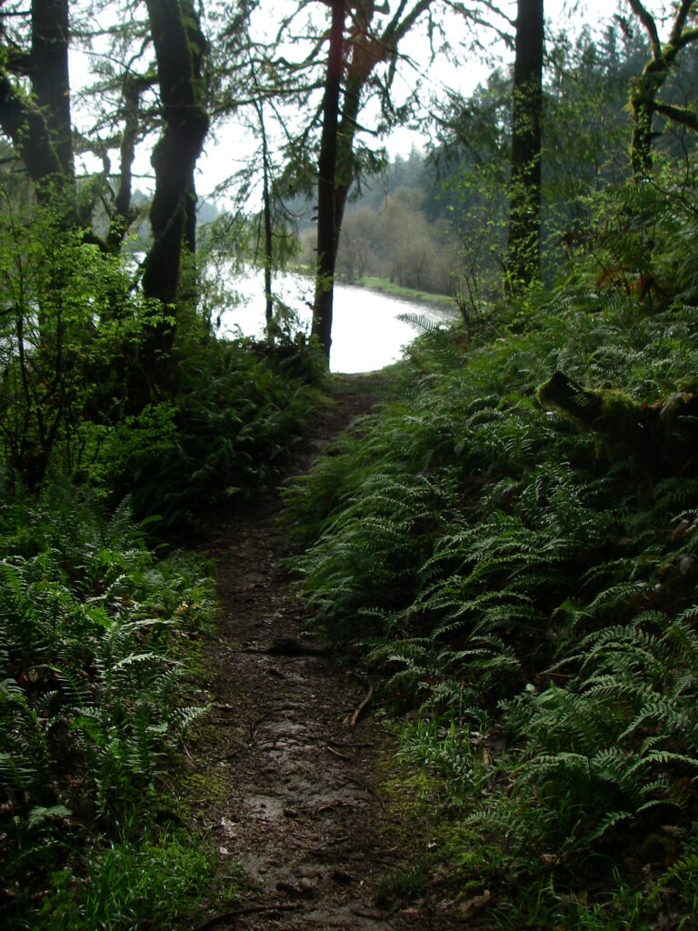
There are three ways to access Paradise Point. The simplest is by a footpath from the state park. The trail is maintained but involves walking up and down short, steep hills. After a quarter mile walk, the trail ends at Paradise Point. A very short section of the trail continues off to your right and leads down to the water edge.
I highly recommend using one of the other two ways to access Paradise Point, both of which involve a paddle and some sweat. As mentioned earlier, Paradise Point is a one and a half mile paddle from the Forks or a two mile paddle from La Center. There is a state owned boat launch on the North Fork Lewis River at the southern end of Woodland’s Dike road. Paddle upstream from the boat launch on the North Fork for a few hundred yards to Forks, take the East Fork Lewis, and paddle past the bridge. Watch the shoreline for the area’s abundant birds. Also keep an eye on the river banks, looking for the tiny channels which access wetland areas navigable only to very small craft. If starting from La Center, a primitive boat launch on the down stream side of the La Center bridge allows access to the East Fork Lewis. From La Center, Paradise Point is a very easy two mile float/paddle downstream. If you can spare a few hours one morning, consider using to it to enjoy a different perspective of one of our local rivers.

