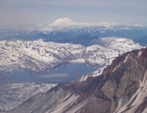
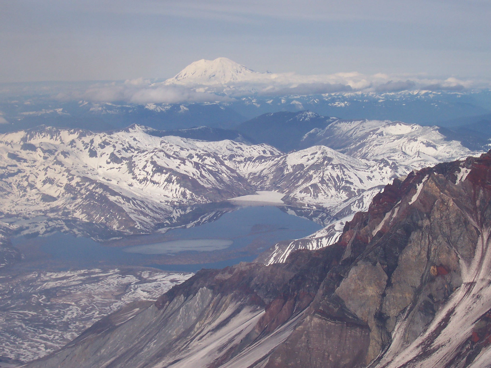
The Swift Reservoir is the first in a series of three large lakes on the North Fork of the Lewis River. The three reservoirs occupy a full 33 miles of the Lewis’ 95 mile length. Providing both hydroelectric power and flood control, the Swift, Yale, and Merwin Reservoirs civilize the Lewis River, transforming the thundering waterfalls, meandering river course, and rushing rapids of the upper Lewis into the calm waters and protected floodplains of the fertile lower Lewis River Valley.

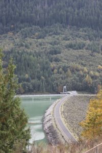
Swift Dam, a 512 foot, earthfill dam built in 1958, created the 4,600 acre Swift Reservoir. The creation of Swift Lake inundated 11 miles of the ancient Lewis River watercourse. At the time it was constructed, Swift Dam was one of the tallest earthfill dams in the world. Today, Swift Dam not only can produce up to 240 megawatts of electricity for use throughout the region, but it also plays a part in controlling seasonal flooding on the lower Lewis River.
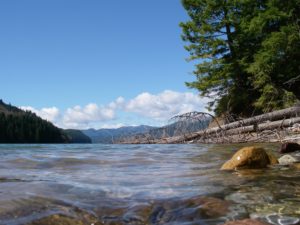
Swift Reservoir lies in a valley nine miles long, and between one half and one and a quarter miles wide. Besides a small, scattered collection of vacation homes along its northern shore, the Swift’s human population is concentrated mainly at Northwoods, a rustic community of cabins at the lake’s eastern terminus. Each summer, the human population swells to many times it rainy season average when a steady stream of recreationalists migrate to Swift Camp, a large campground on the north bank of the lake. Just over a mile downstream from Northwoods, Swift Camp offers the only public-use boat launch on the reservoir, and, in conjunction with Northwoods, serves as home base for the fleet of jet skis, fishing craft, and play boats that ply the sunny, and crisply refreshing waters of the Swift each summer.
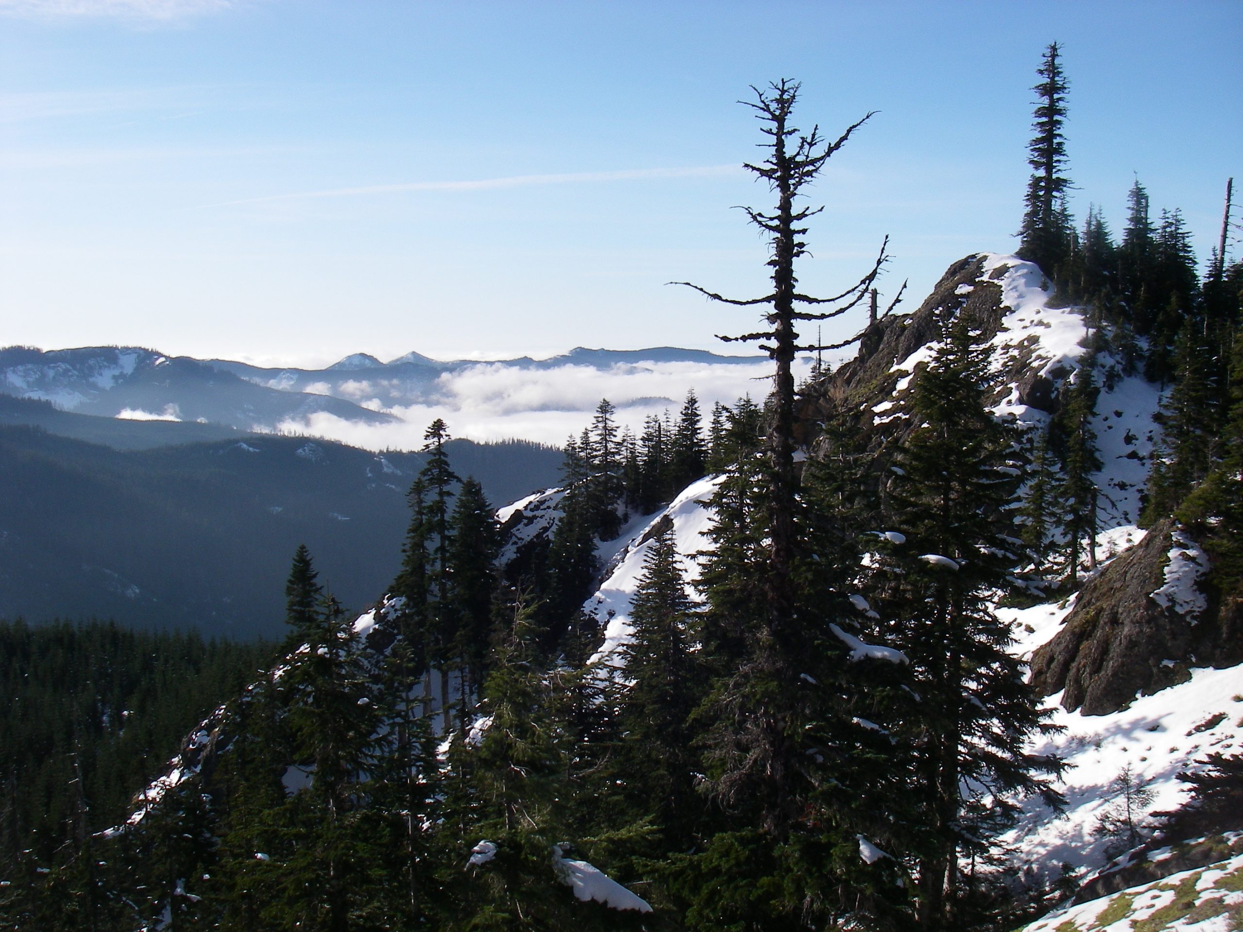
Two roads link together in a loose embrace of the Swift. The Forest Service 90 road begins just east of Cougar, traces the sharp contours of the Swift’s northern bank, and passes Northwoods 16 miles. The 90 road, one of the only paved routes into the Mt. St. Helens and central Gifford Pinchot areas, serves as a recreational pipeline in the summer. A pleasant off-season drive for the unhurried traveler, the 90 meanders through the dense forest of the Gifford Pinchot, and sports a small viewpoint of the Swift and surrounding mountains at the 10 mile marker. Opposite the 90 lies the IP-10. An old, gravel main-line logging road, the IP-10 is gated at its east and west entrances. Akin the 90, the IP-10 traces the rugged southern bank of the Swift, allowing occasional glimpses of Cascade scenery. Due to the gates, very difficult foot access, and the relentless deconstruction by nature’s forces, the IP-10 is slowly morphing into beautiful backcountry.
As with most anything, the most effective way to experience the Swift is to jump in. A springtime paddle to the Drift Creek inlet offers the curious explorer a rewarding sample of the Swift. Drift Creek is one of a number of tributary streams that flow down the steep draws of the surrounding high country to empty into the reservoir. Beginning high in the Paradise Hills northeast of the Trapper Creek Wilderness, Drift Creek meanders south, then west, and finally north along a rapidly descending course that ends in a long, now submerged, valley. Delivering an annual impulse of snowmelt and percolating rainwater, the Drift’s gently-rushing, briskly-cold contribution explains the pickling sensation and newborn purity of the Swift. Leave a limb to soak in the springtime Swift and you find yourself quickly reminded of the origins of all this water, snowpack.
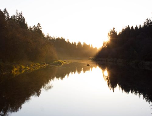
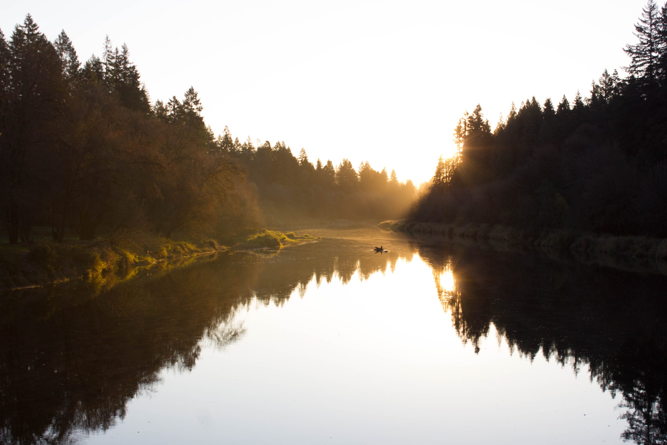
Drift Creek’s mouth lies at the southern end of a mile and a half long inlet. From inlet to the Swift Camp boat launch is two miles, resulting in a very reasonable three and a half mile paddle from boat launch to tributary. If you make the effort to arrive at the boat launch early in the day, you can look forward to the reward of paddling across the Swift with the sun rising over your left shoulder, silently emerging from behind the hills east of McClellan Mountain. Hug the southern bank after you pass through the driftwood barrier that stretches accross the lake just west of Swift Camp. As you paddle along the southern shore you may catch a glimpse of an elk herd, eating their way through the morning.
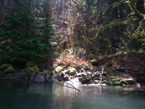
A forested island marks the entrance to the Drift Creek inlet. As you pass the island to its left, swing to the south and enter the inlet. If you arrive sufficiently early, the tree-filtered morning sun becomes an unassuming chartreuse accent that blankets and highlights the eastern bank of the inlet. The gentle morning backlighting reveals details usually lost to the macro views that are best saved for later in the day. A silent bustle of insect flight is punctuated by the flash of fish feeding on bugs foolish enough to alight on the water’s surface. A small convoy of ducks pushes forward, creating miniature bow waves in the dust and pollen which spin slowly in the countless micro currents of the inlet’s nearly imperceptible flow.
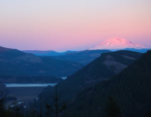
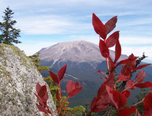
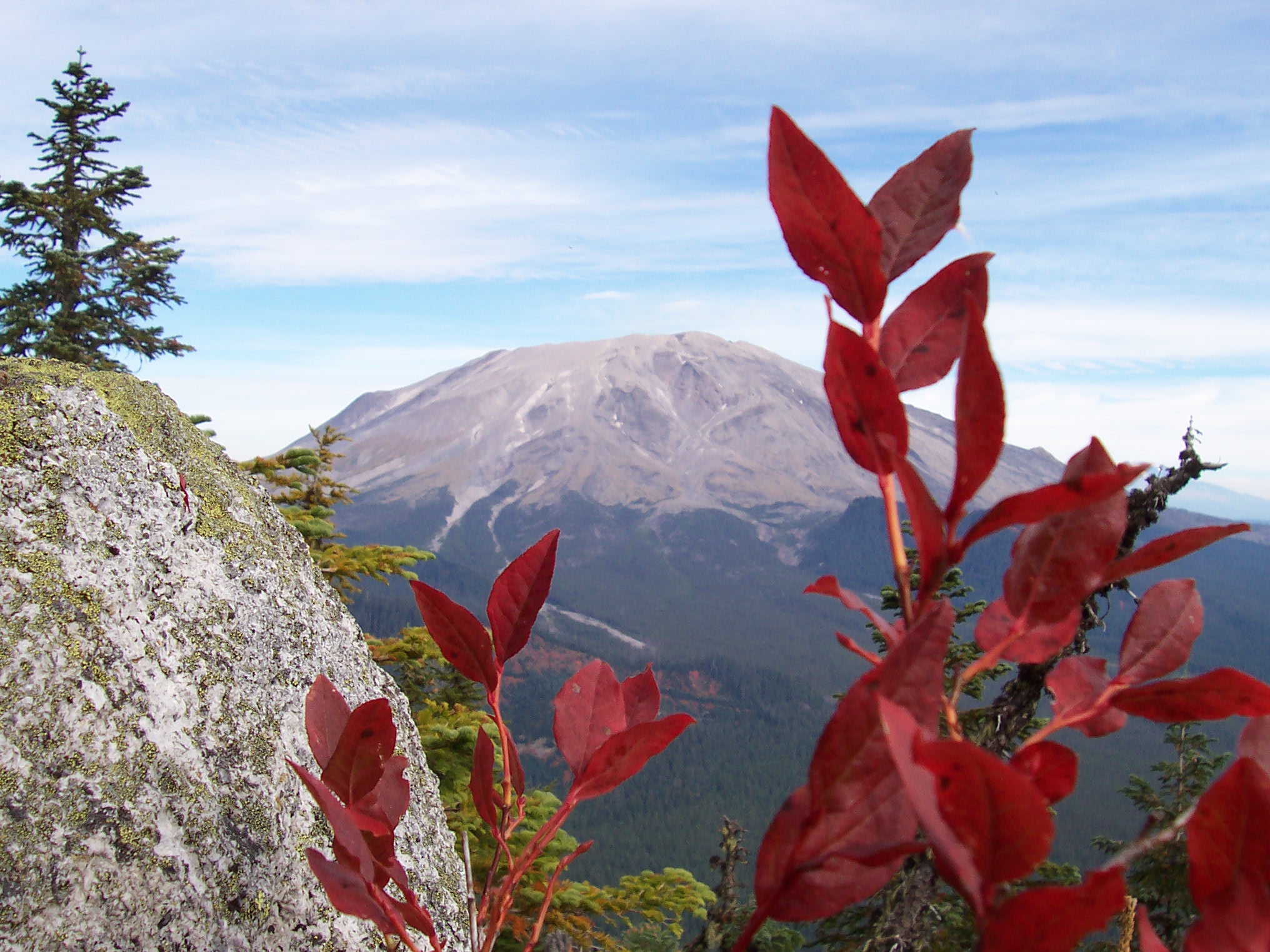
A handful of unofficial campsites are spread out on either bank of the inlet. Most have a hand built table for dining convenience, and small landing useful for small craft. While the sites on the western bank sit closer to the water and make easy access points for a picnic lunch, the eastern sites, closer to the inlet mouth, include views of Mt. St. Helens’ crater rim peeking out over Marble Mountain’s timbered top.
Drift Creek itself spills out in a rushing narrow stream at the eastern corner of the inlet’s terminus. Bubbling and pushing, the creek pours over boulders and logs, eager to add its meltwater to the Swift. Wind protected and warm in the sun, Drift Creek inlet offers an idyllic immersion experience for a paddler exploring the Swift.
Swift Reservoir marks the full transition of the Lewis River. After thirty-six miles of maturing from trickling alpine rivulet into a rushing, waterfall-infused mountain river, the Lewis begins its productive phase. Though only a byproduct of the need to produce electrical power for the region, the Swift dam also provides a calm, protected venue to experience the rich, wet life of the Pacific Northwest.

