
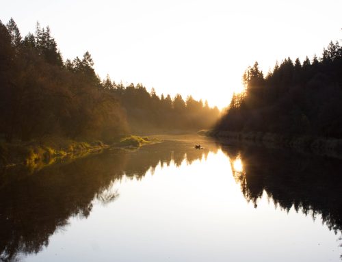
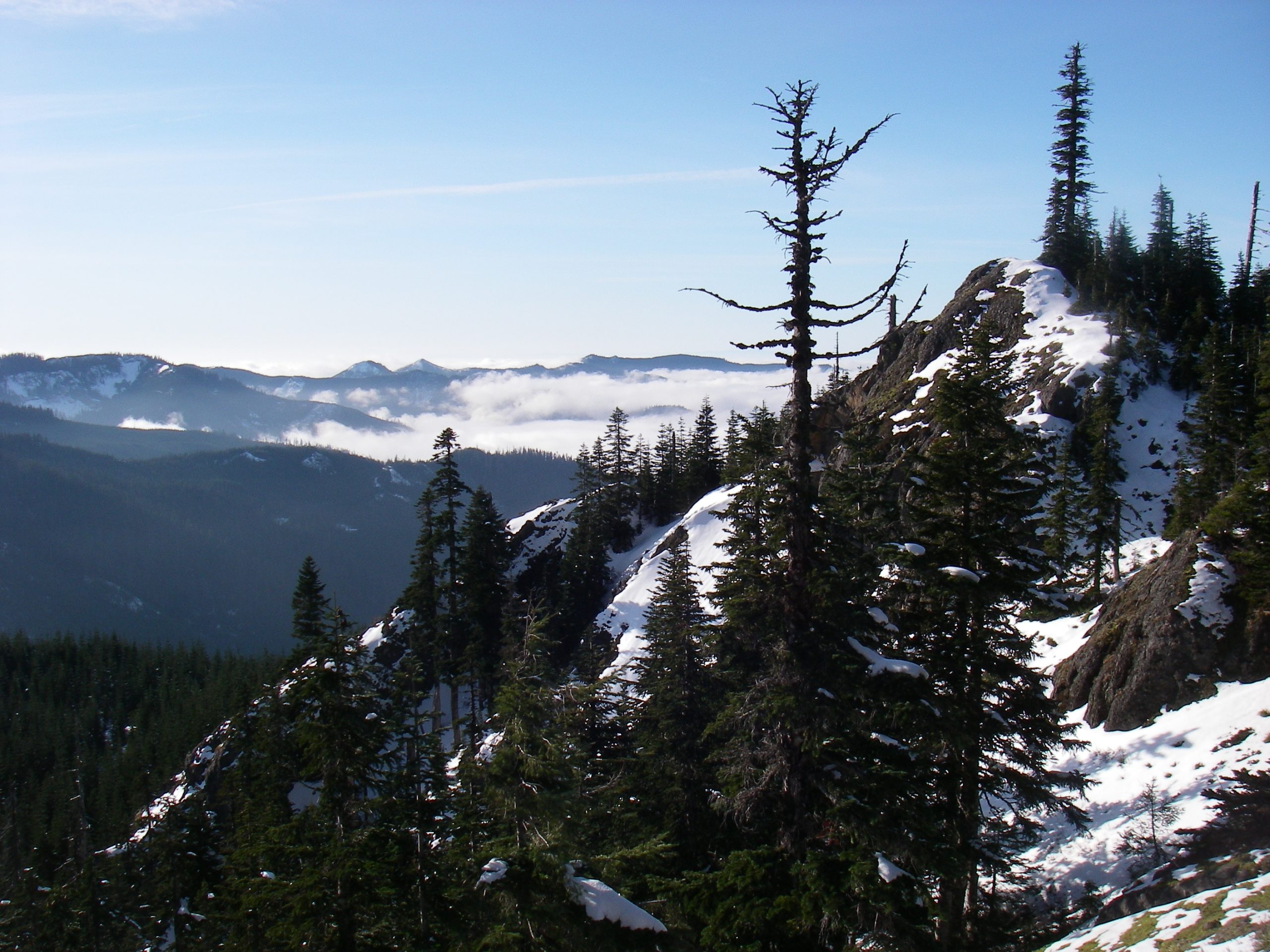
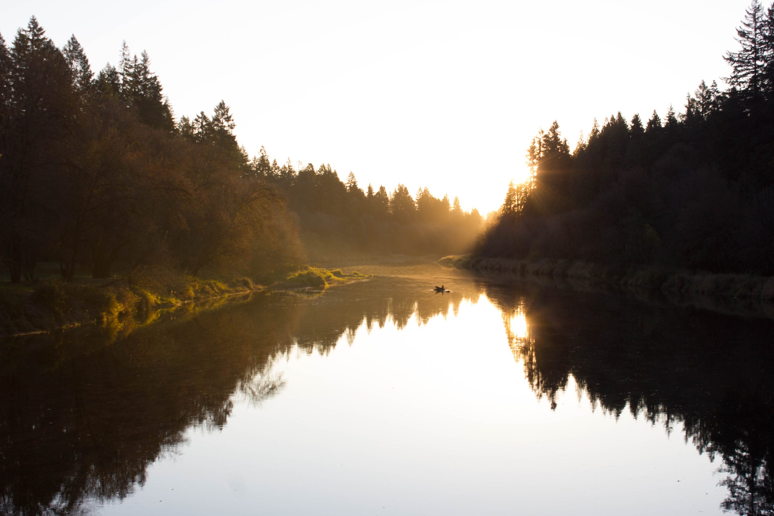
A variety of natural beauty makes Woodland a great place to live. Mountains and wintery snow are a short drive upriver and the beauty of the Lewis and Columbia rivers is practically at our doorstep. As I type, a weather system is adding upwards of three feet of snow to our mountains. That mountain snow will stay with us, hopefully, until the arrival of summer heat. By the time you read this, however, Woodland’s lowlands will be straining against winter’s weakening grip. Any sunny day in the Woodland bottoms briefly transforms winter into spring. Though our local dikes were built for one specific and necessary purpose, to protect our town from yearly flooding, these asphalt-capped piles of stone and dirt also manage to showcase Woodland’s beauty year-round.
The roads of our dike and farm areas are ideal for pleasant tours of any length. A car will work in a pinch, but one can tour Woodland’s river bottoms, via bicycle, or legs, in any season of the year. A twenty minute excursion may be all that is necessary to clear a mind, calm a nerve, or end a day. Multi-hour, two-score mile, bicycle adventures require as little planning as scheduling some time. It matters little if you have a short lunch break or half of your day; your goal a quick walk or a personal feat of endurance. The bottoms offer a distinctly local opportunity to get some exercise, and a reminder that beauty is just a step outside.
Downtown roads provide good options for quick walks. Following Davidson road west out of town takes you over the railroad tracks just past 6th st. A good, short walk is to simply continue straight along Goerig. A longer version is to cross the tracks and then follow North Pekin road, and turn onto Caples road. Walks on either of these roads allow one to enjoy the open feel of the bottoms, their beauty and that of the hills that surround Woodland. Runners can fairly easily access the rivers from downtown. A longer jog is a six-mile, out and back run, from downtown along North Pekin and Caples roads that has a mid-point rest stop at the Columbia river. One can also follow 5th St. and South Pekin Road out to a Lewis River rest point. Round trip five miles.

For those who are bicycle equipped, a great loop is to ride around the entirety of the Columbia river dike. Following Davidson avenue, turn left onto 5th street, ride past the Lilac Gardens and through the residential area. About three quarter miles past the intersection of 5th and Davidson follow the road right onto Whalen road. Immediately after crossing the railroad tracks look to your left for Kuhnis rd. Turn left onto Kuhnis and ride through the tree-tunnel, which opens up after a few hundred yards. For the next mile and a half the farming fields and the hills west of the Columbia provide a great introduction to the dike road’s scenic value. Just shy of three miles from our start, Kuhnis road swings right and climbs onto the dike, here running along the last bits of the Lewis river. To your left, across the river, is the northwestern-most part of Clark County.

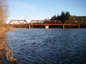
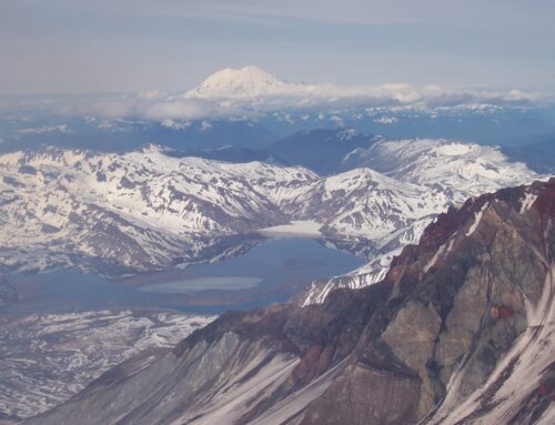
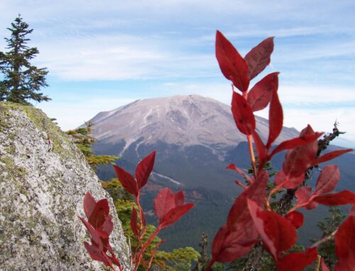
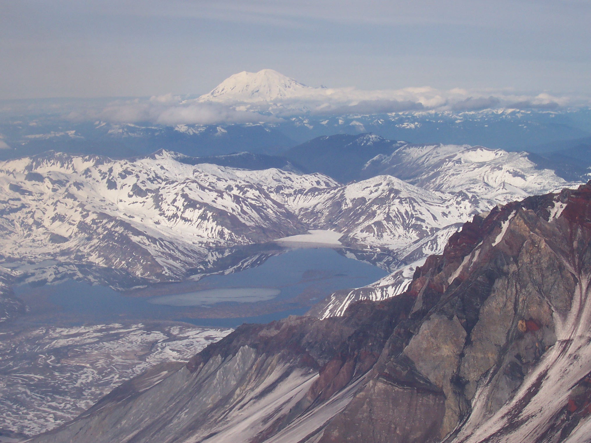
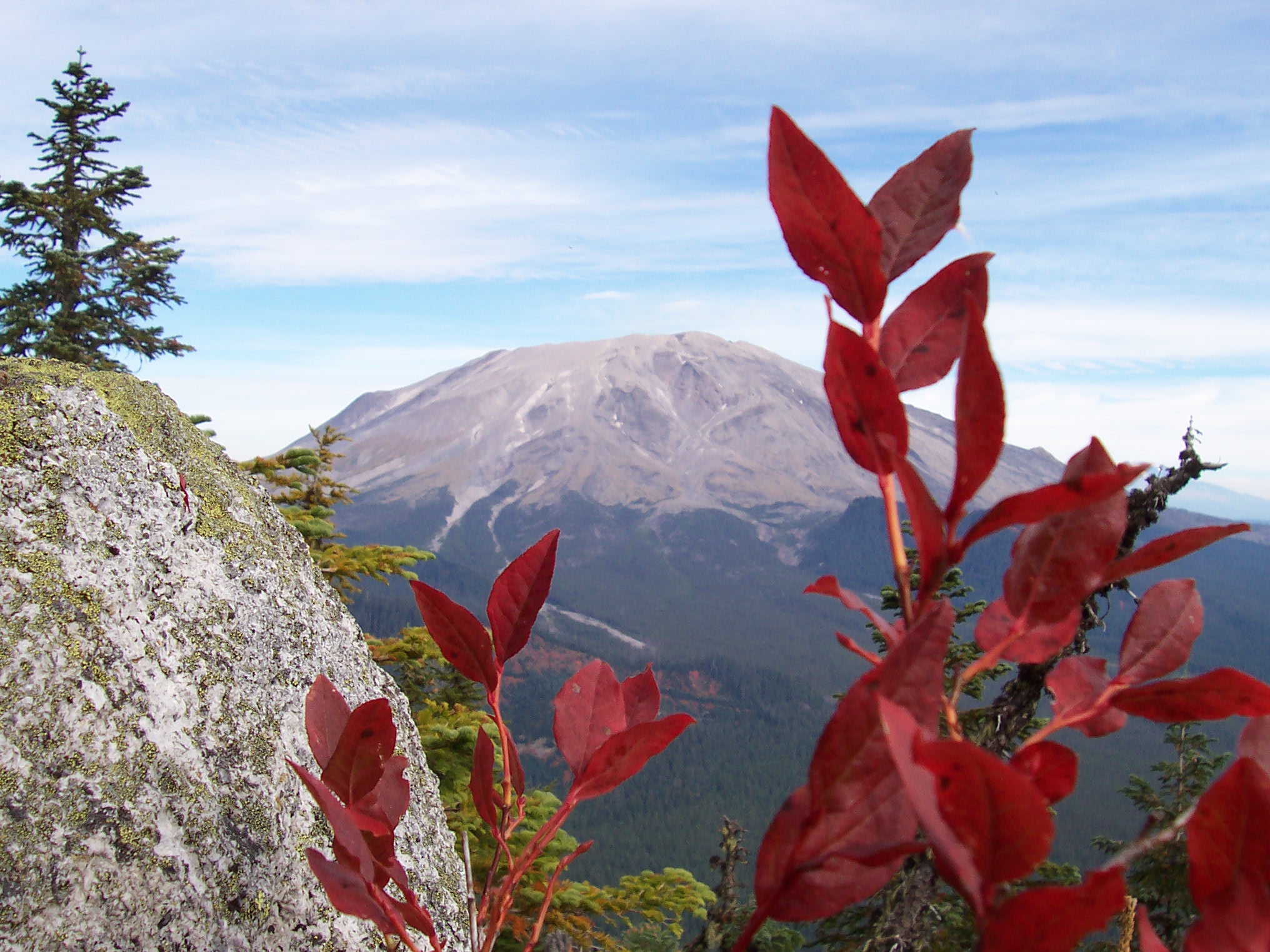
As you ride west along the Lewis, keep your eye out for the hawks who favor nearby fields as hunting grounds. When the river is running low, a small shipwreck is visible on the southern shore as you approach the fourth mile of the ride. At four miles, the Dike road will gently swing to the north, now running along the Columbia river. Look hard over your right shoulder after the sweeping turn, you can catch views of Mt. Hood if the weather is clear. Also watch for Mt. Adams, looking up the North Fork Lewis river valley, and the top of Mt. St. Helens after you pass Whalen road at six miles. Next, Caples road meets the Dike road at seven and a half miles. One may make a shorter loop by simply taking a right at either Whalen (8.6 miles total loop) or Caples (10 miles total loop) roads and heading back to town.

If a break is required, there are beaches directly to the west of the Caples road intersection (7.5 miles) and at Lions Day Park (8.1 miles). Both beaches are great places to stretch, drink water, and appreciate the largest river west of the Mississippi. The next turn is at 9.3 miles where the Dike and Dike Access roads meet. Take a right onto the Dike Access road and follow it for just over a mile, turning right again onto Burke road at the 10.4 mile mark. At 11.2 miles the road will intersect with Guild road. Take a left at the stop sign and follow Guild road for 0.75 miles, then take a right onto Pekin. At 12.8 mi Pekin road will swing left and cross the railroad tracks, depositing you onto Davidson road and completing the loop.
Whether you have twenty minutes or two hours, the Woodland Bottoms are a beautiful part of Woodland in which to relax, exercise, and be grateful for this part of the world that we live in.

