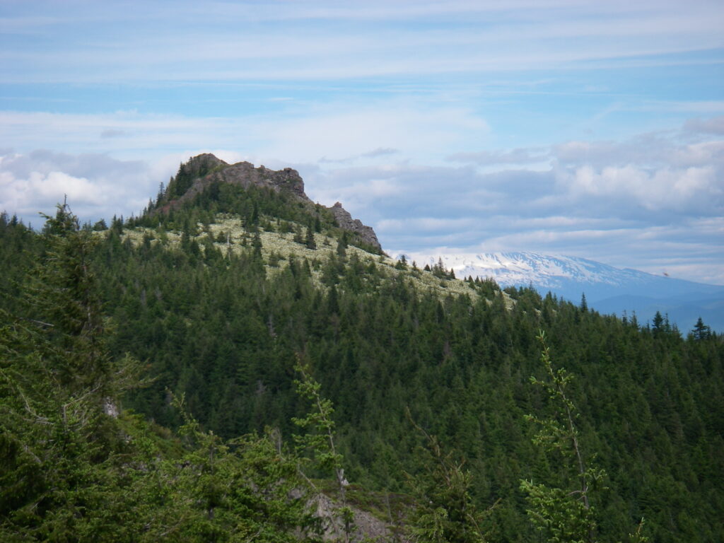
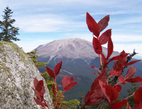
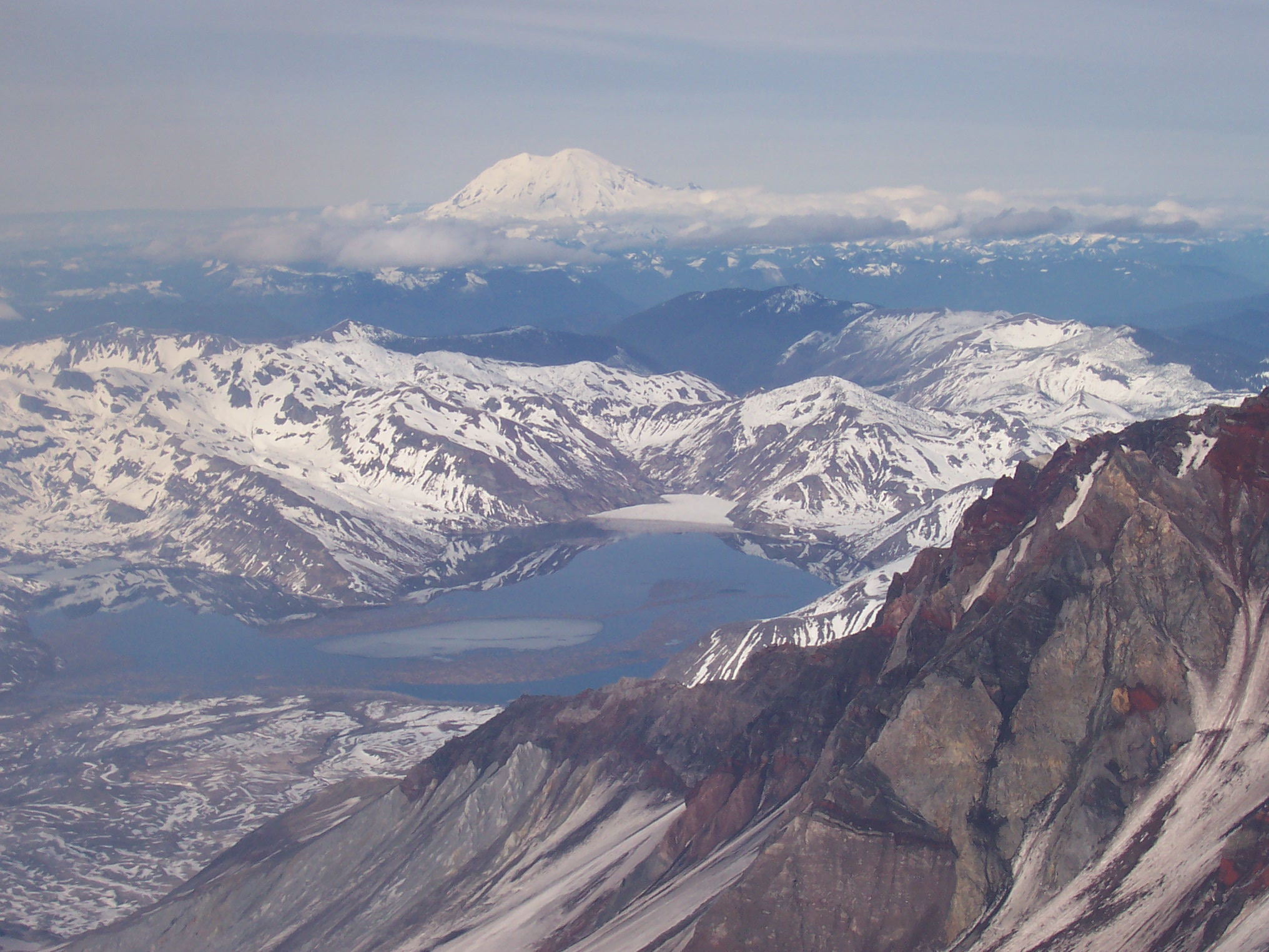
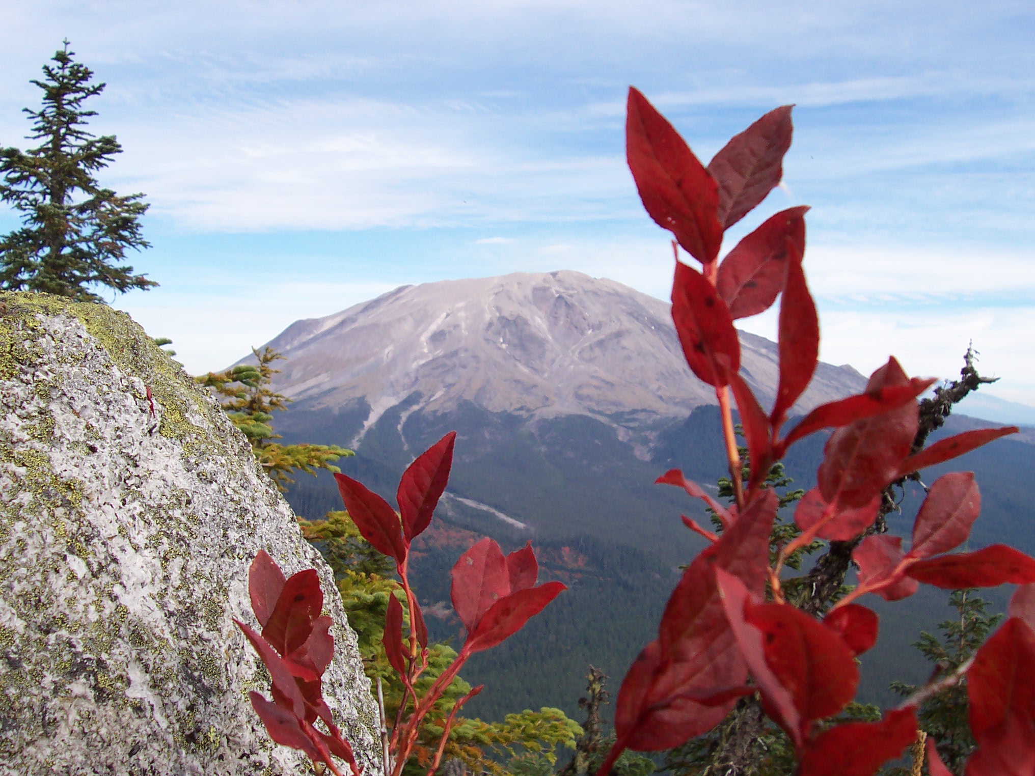
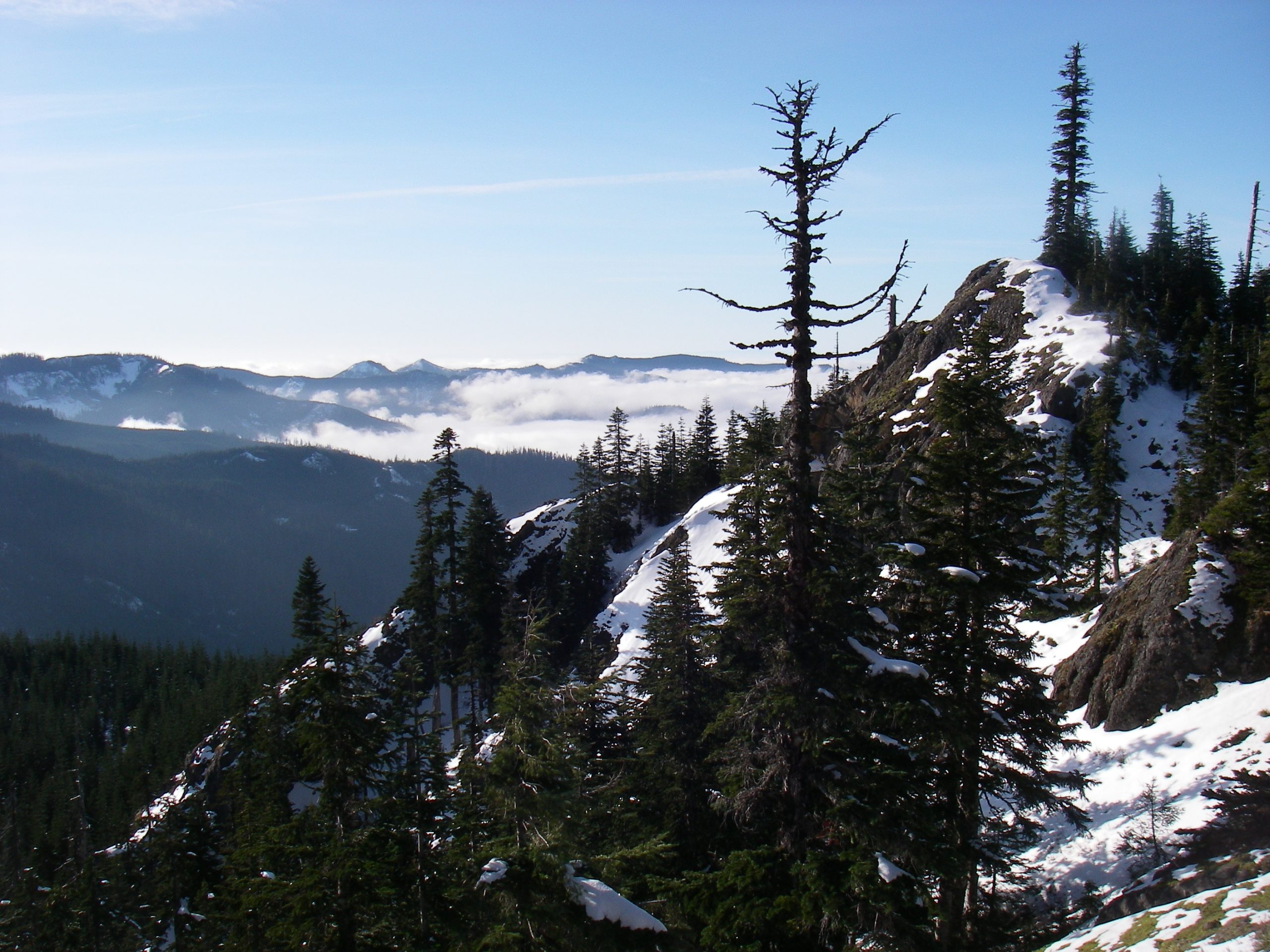
Mt. Mitchell is a craggy, minor mountain tucked neatly away in a patch of state timber-land across the Lewis River from Mt. St. Helens. Once the site of a now long-gone fire lookout, Mitchell is a curious blend of the economical productivity of the timber industry, the afterthought of a state DNR trail, and, due to its inclusion in area guide books, a destination for Portland area urban hikers. Like many other alpine peaks throughout the Gifford Pinchot National Forest, Mitchell provides excellent views of all the neighboring volcanic mountains: St. Helens, Adams, Hood, Rainier, and on a very clear day, Jefferson. At over 3,900 feet in elevation, Mitchell’s summit sits high enough above its trailhead to make it both attainable for most trekkers, yet difficult enough to bring a sense of satisfaction with the effort required to climb it. Mitchell is distinct from other area peaks in that its summit topography includes not only the usual rock formation, but also an expansive and picturesque alpine meadow.
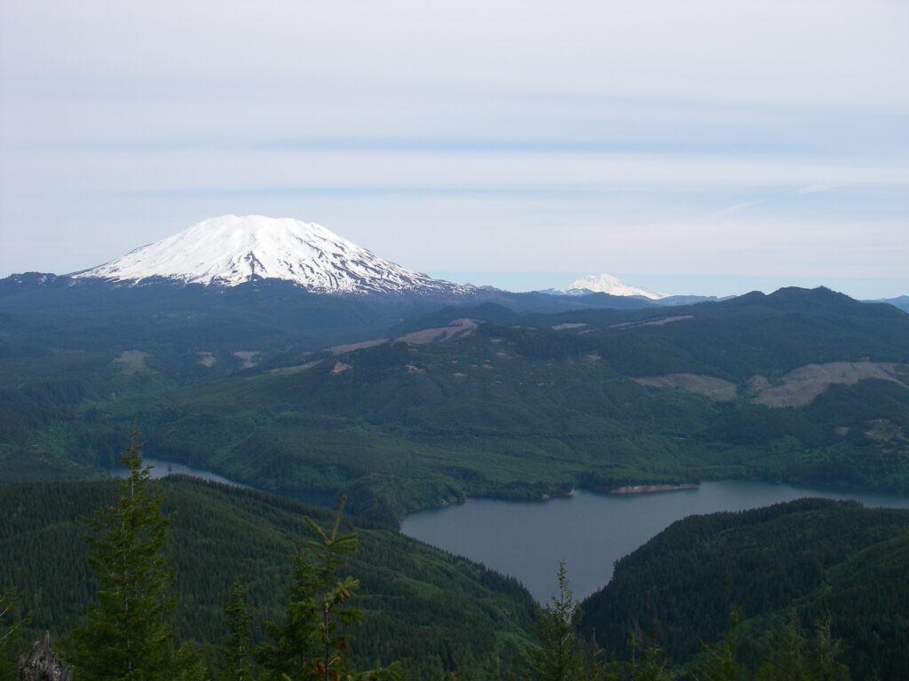
After the 0.75 mile mark, the trail swings south east and levels out a bit. Generally you can make good time as you hike this section between the 0.75 and 1.5 mile marks. You will cross two stream gullies in this stretch of the trail. In spring and fall, these gullies are good places to get water if you have a filter and decided to forgo carrying water up the steep initial section. In clear weather the gullies also provide a snapshot of the terrain around Mt. St. Helens, a taste of the panorama that you will see from the summit.
Just before you reach 1.5 miles into the trail, after a brief and minor descent, the trail will again resume its ambitious upwards progress. More switchbacks are to come, but at this time the trail simply steepens and again requires some good exertion. After the trail steepens it will cross several rock talus fields. These talus fields provide more glimpses of the upcoming views, this time of the Siouxon creek drainage south of Mitchell. After crossing the first talus field, watch for a short spur trail to the left, it leads to a chunk of rock that may have very well been specifically designed for sitting, snacking, and photo opportunities. It’s almost as if the trail has a built in, mid-point rest stop.
The next half mile of trail continues the steady climb with intermittent views of the Siouxon drainage and also of Clark County in the distant southwest. Watch for small rivulets of water where the trail crosses the upper talus fields just before the 1.75 mile mark. In summer, these tiny streams are some of you final chances for water, if present. If you miss the tiny talus streams, one last chance for water occurs near the 1.75 mile mark at a fairly obvious small stream crossing. This stream does go dry later in summer.
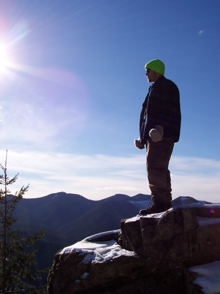
At the two mile mark you will begin to move into sub-alpine vegetation. Bear grass begins to take over from evergreen and fern, soil yields to rock. A final set of switchbacks deposits you into the gorgeous alpine meadow near Mitchell’s summit. As you walk through the meadow, the summit rock formation beckons and promises an end to your legs’ work. A short rock scramble and you can rest. Bring a snack, some water, even a book, but definitely a camera, Mount Mitchell’s summit has one of the better views in the southern Gifford Pinchot.


