In the Lewis River valley, fall is a time of rain, wind, clouds, and cold. The Cascade high country amplifies this seasonal weather change. I would be lying if I said I enjoyed our mountain, and all its elements, throughout all four seasons. In reality, I’m not big on wet clothes, cold hands, damp sleeping bags, and blowing rain. But as maturity makes halting, sporadic progress, I’m learning to appreciate our mountain in all its seasons. Thus, I’m learning to enjoy our mountain even in the moist, chilly autumn.
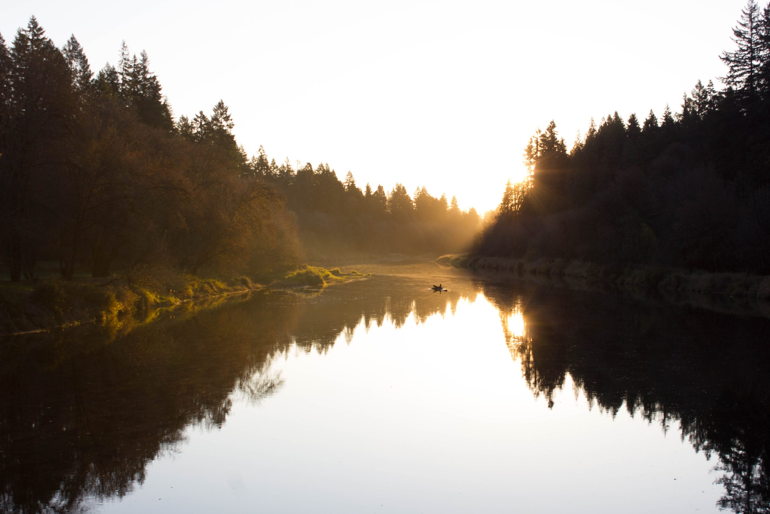
Butte Camp Trail near the water source.
Like spring, fall is a time of transition. Gone now, the mountain’s ashy summertime heat and dust. Gone also, the horde, one hundred strong, of daily climbers plodding up Monitor Ridge toward the summit. The colder and shorter days of the alpine autumn signal the arrival of the brilliant oranges and reds of dying leaves. Cloudy weather announces the potential for colorful twilights. The commencement of rain and wind give a taste of the strength of our upcoming winter.
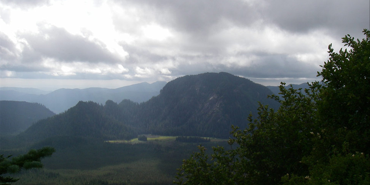
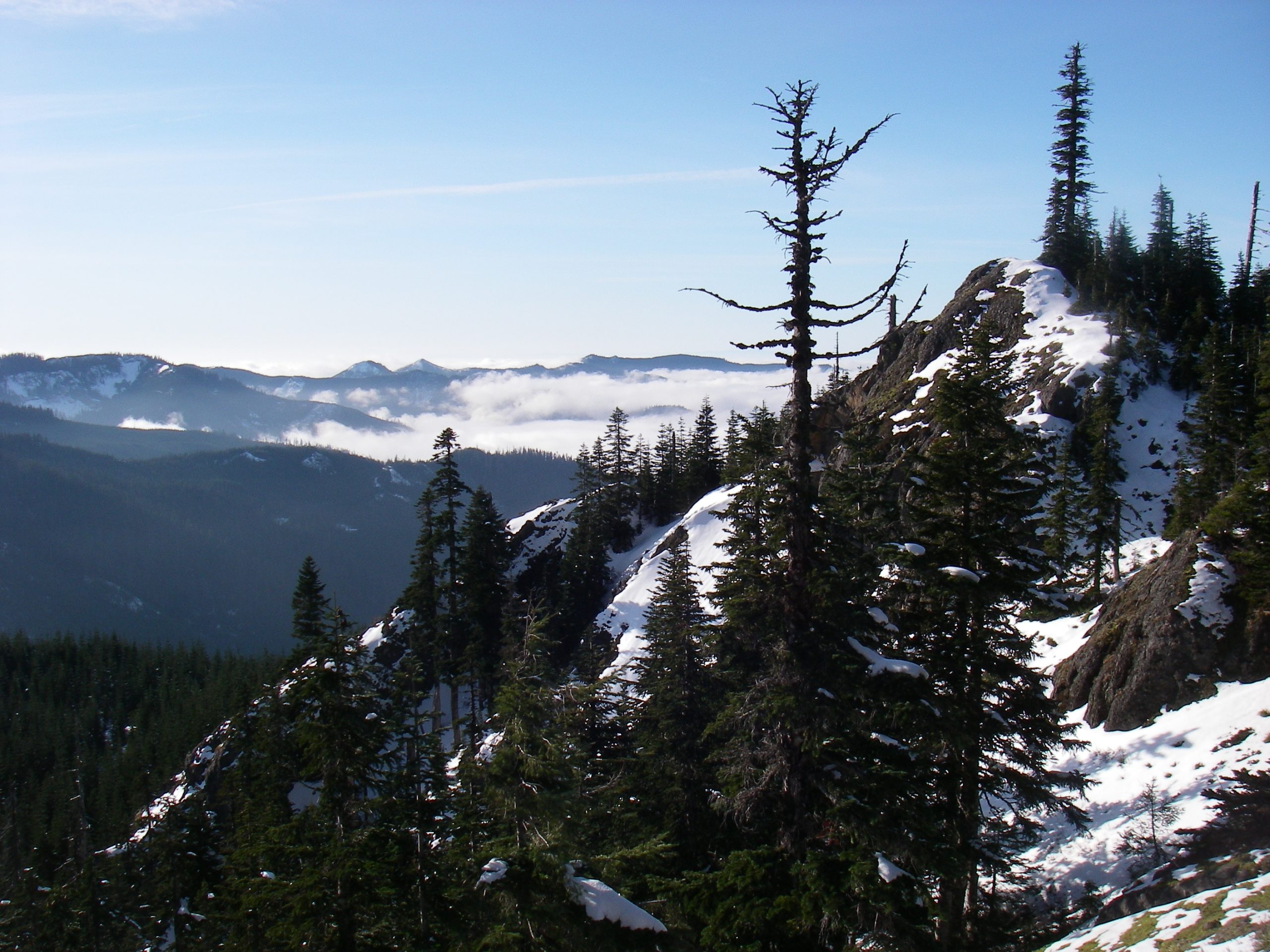
Hiking the treeline of the southwest corner of Mt. St. Helens is a wonderful experience in the fall. One way to get onto this part of the mountain is the Butte Camp Trail via the Forest Service 81 road. The 81 road departs from highway 503, just west of Cougar, and twists north and then east for a total of sixteen miles, gaining 2,000 feet of elevation along the way. Named for the red rock seen nearby, Redrock Pass lies at the summit of the 81 road. Though the upper, gravel, section of the road near Redrock Pass is subject to periodic washouts, it is currently open to all vehicles. Gaining 1,500 of elevation feet over its 4 miles, the Butte Camp Trail connects Redrock Pass with Mt. St. Helen’s treeline trail, the Loowit.
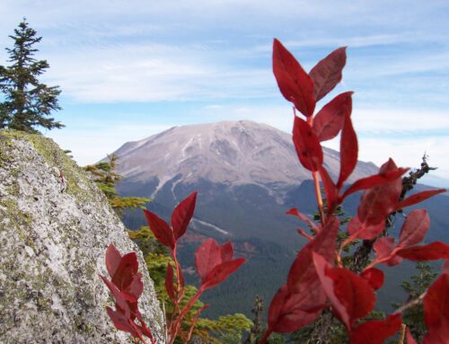
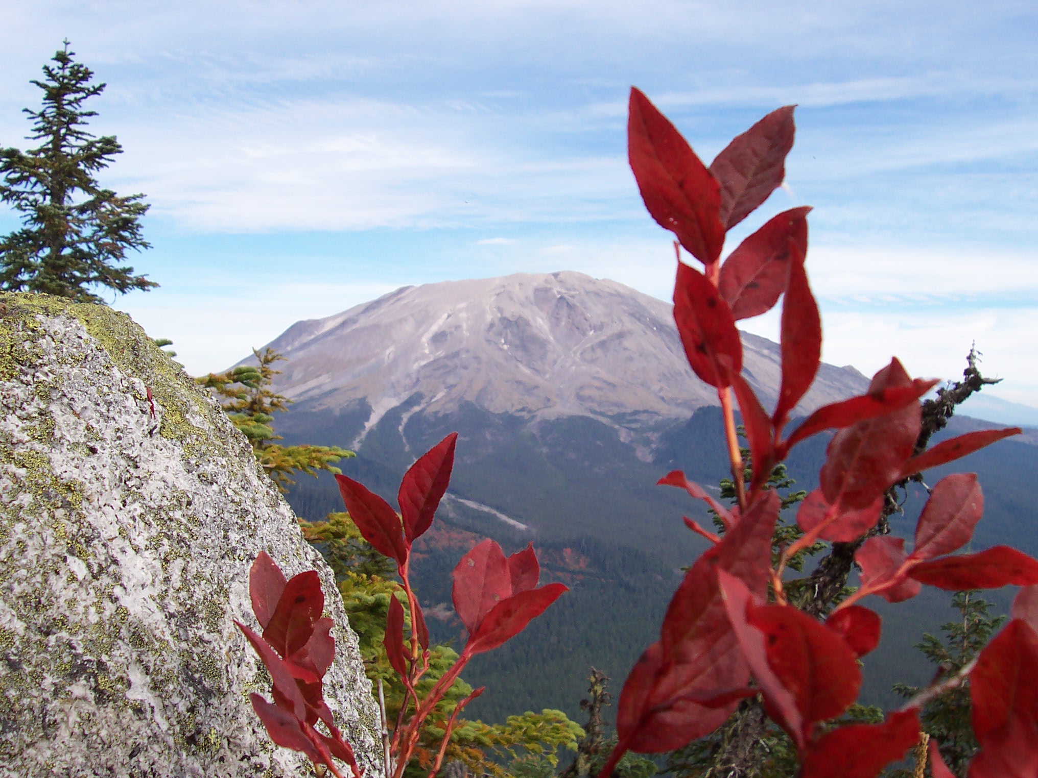
The Butte Camp Trail is unique in that, within a few seconds of departing the trailhead, one can see the entirety of the trail’s route. A short climb out of the parking lot deposits a hiker on an open lava field. Suddenly before them, looming, stands the massive bulk of Mt. St. Helens. Just to the right, deceptively close, lie the Twin Domes on the mountain’s left flank. Using a map as a reference, one can trace out the trail’s path, from trailhead to treeline. The evidence of volcanic activity seen on the southwest side of Mt. St. Helens is in sharp contrast to the recent, violent, and still raw destruction present on of the northern and eastern aspects of the mountain. At this point in history, the southwest slope’s old lava flows, uplifted ancient rock, and huge domes have all been reclaimed, and somewhat tamed, by plant and animal life. The Butte Camp Domes are a pair of steep, tree-covered, stone hills protruding up from the mountain’s southwestern corner. The domes, also known as the Twin Domes, are products of this older volcanic period. These watchtowers lie right at the edge of St. Helen’s treeline. As a result, they are a striking mixture of viewpoints, dense trees, and alpine meadows.
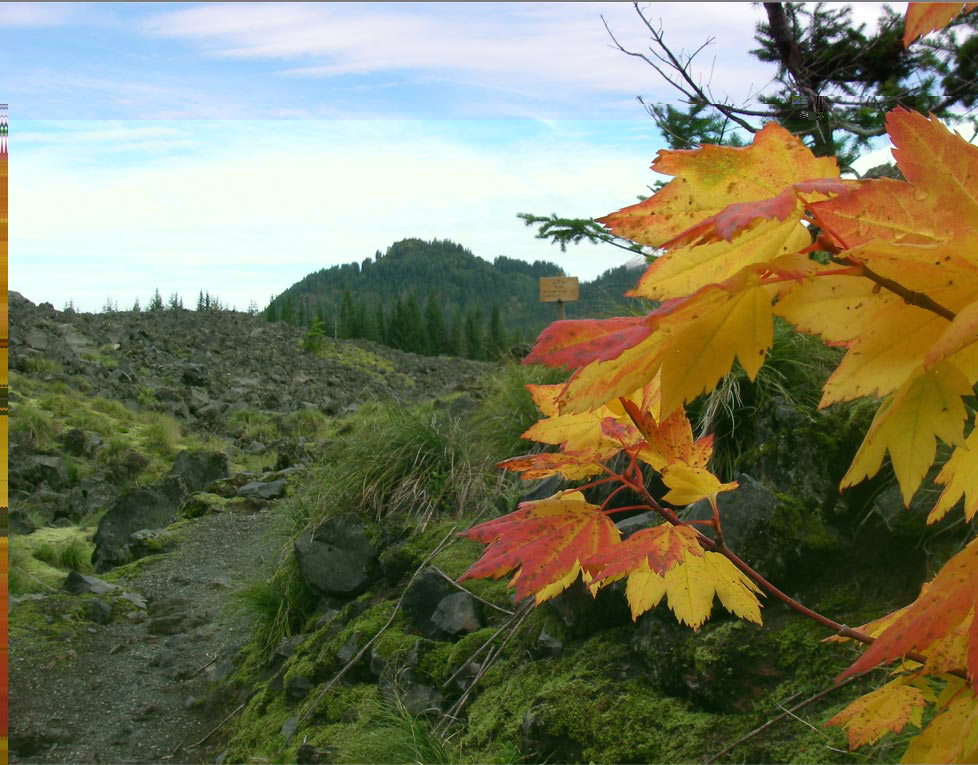
Fall colors on vine maple trees greet you on the trailhead.
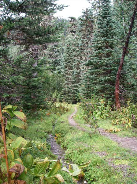
The Butte Camp Trail spends its first mile moving through a wide lava field and then dark, lower-altitude forest. You will pass two marked trail intersections along the way to treeline. The first is the 231 trail, which is primarily a low-use winter ski trail. The second is the 238 Toutle trail, which connects the Butte Camp Dome trail with Goat Marsh, and marks the transition into thinner forest and more frequent old lava flows. Keep in mind that the 2006 storms washed out the 238 trail northwest of the domes. If you decide to explore the 238 trail, it ends in a washout as you pass to the south of the domes.
Past the 238 trail intersection, the trail steepens somewhat and provides occasional views of Goat Mountain. Follow the trail as it continues another one and a half miles and eventually flattens out as it arrives at the Butte Camp meadow. This meadow is a great area to set up camp. It is wind sheltered, has a nearby, year-round, water source, and is close to the domes and Loowit trail.
You may be tempted to consider Butte Camp as your final destination. Don’t. Climb the last one and a half miles of trail, through the last bits of forest, and explore the mountain’s flank. The final section of the Butte Camp trail is a transition from forest to alpine environments. Old boulder lava fields, expansive alpine meadows, views of Mt. Hood and Mt. Jefferson, marmots, and elk are all within a twenty minute walk. Brave the rain and some cold and you’ll be rewarded with an experience not possible in the comfort of our valleys.

