Mt. St. Helens has an older sister. An older sister that long ago enjoyed a brief career and retired to a quiet neighborhood. A sister volcano who’s career never really took off. She did good work in her time, no doubt. It is hard to miss the bulk of the enduring basalt spires, which are the fruit of her ancient labor. But the magma which drives volcanic activity sought another outlet before she could cover the land with lava flows, lahars, ash and pumice. That mysterious, perhaps subtle, subterranean shift that changed the direction of the magma flow ended the older mountain sister’s growth. That shift in magma then initiated the long and eventful career of Mt. St. Helens, while also signaling the beginning of a long period of rest for her older sister, Goat Mountain.
 Goat Mountain is a bulky, and very steep, 4,960 foot basalt lava dome which dominates the terrain west of Mt. St. Helens. Standing over 1,000 feet taller than any of the surrounding ridges, and possessing a mile long foundation, Goat Mountain provides the framework for everything west of Mt. St. Helens. The mountain, with its southeast running southern arm, forms a crescent which cradles Goat Marsh, a fascinating wetlands area resting on Goat Mountain’s eastern base. That southern arm descends into a series of mini-peaks, each a strenuous and rewarding hike in their own right. That arm is a punishingly steep elk playground, with no trails, frustratingly thick vegetation, and numerous viewpoints. On the opposite end of the mountain, Goat’s northern ridge quickly drops from the summit to a steep valley that empties into the Toutle River. The western and eastern faces are wide, steep, and full of avalanche chutes. The eastern face is dominated by cliffs and contrasts beautifully with the flatness of Goat Marsh at its base. The tree-covered western face provides the only realistic climbing route for those without rock climbing skills.
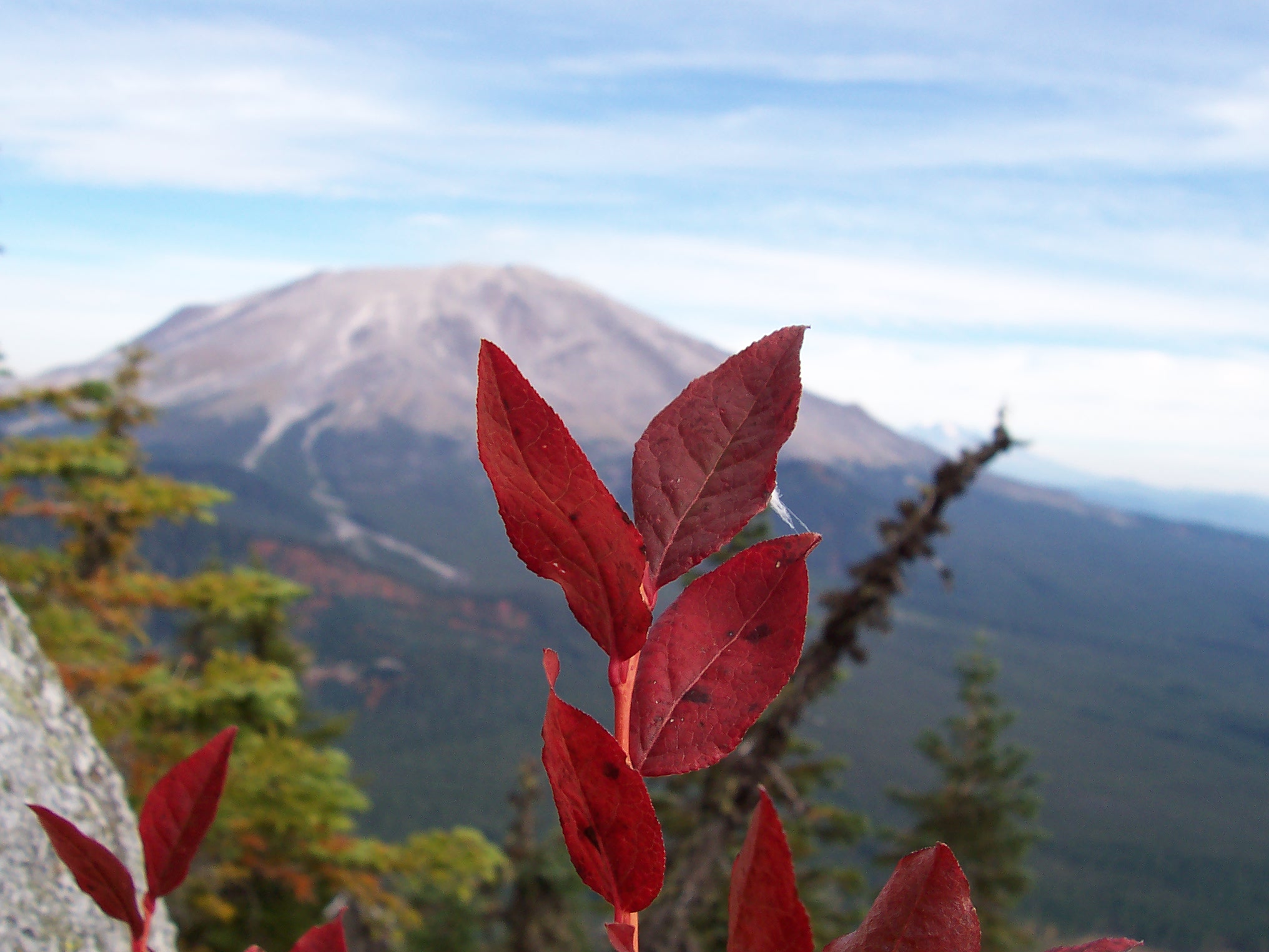
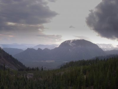
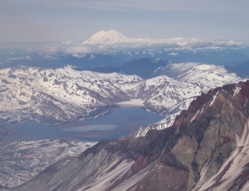
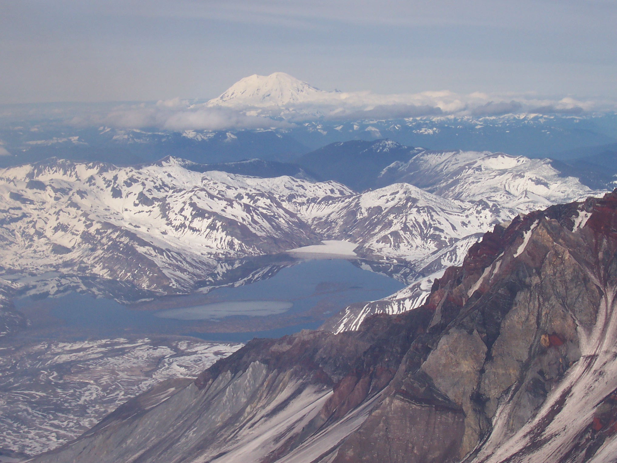
 It is five and a half miles between the summits of the two volcanic sisters. The area in between is a unique product of volcanism, with craggy sheer cliff faces, a small chain of wildlife-packed ponds, forest-covered ancient lava flows, boulder fields, flood scoured gullies, and the mighty twin domes. Few places so readily display not only the obvious evidence of fresh volcanic activity, but also a real-life visual time-line showing the stages of nature’s recovery from eruptive destruction. One can stand on the summit of Goat Mountain, looking east, and see this natural time-line. A time-line orders of magnitude more informative and spectacular than any diminutive national park interpretive sign. If you look at the summit of Mt. St. Helens and and let your eyes travel west, the land displays the stages of recovery. From the ash-covered slopes of St. Helens, so recently ejected from the earth, moving through boulder fields, scrub forest reclaiming lava, mature forest on basalt bedrock, to the fully-recovered ecosystem of Goat Marsh one sees the stages of natural recovery. As with most of the rewards of the forest, the view from Goat Mountain’s summit isn’t a product cheaply purchased. The price for reading the story of nature’s recovery is to physically experience the size of Goat Mountain.
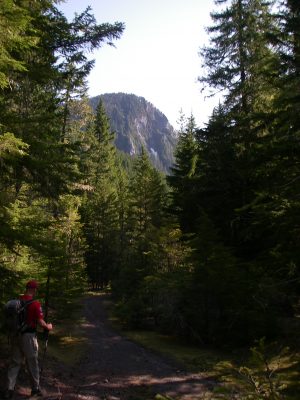 The path to Goat Mountain’s summit begins two and a half miles away at the US Forest Service Road 81. At the nine mile marker of the 81 road lies Kalama Horse Camp. Just past the main entrance to the horse camp, on the north side of the road, is the trail head for the Fossil Creek trail. The Fossil Creek trail is a five mile long path that connects Kalama Horse Camp with Blue Lake. For the first few hundred yards past the trail head, the trail moves over a relatively flat, now forest covered, old lava flow. At the 1/2 mile point, the trail begins to climb up a thickly forested ridge. The forest thickens as the trail completes the first mile, moving through two gentle switch backs. Here the trees, planted firmly on old soil instead of recent lava, grow taller and fatter. Ferns, vine maple, alder, and a thickening tree canopy all conspire to darken the trail through most of the second mile, giving it the characteristic western Washington feel of subdued sunlight and green/brown hues.
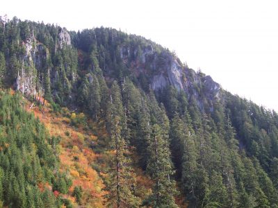
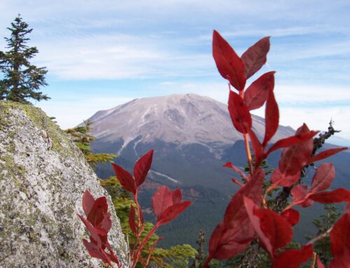
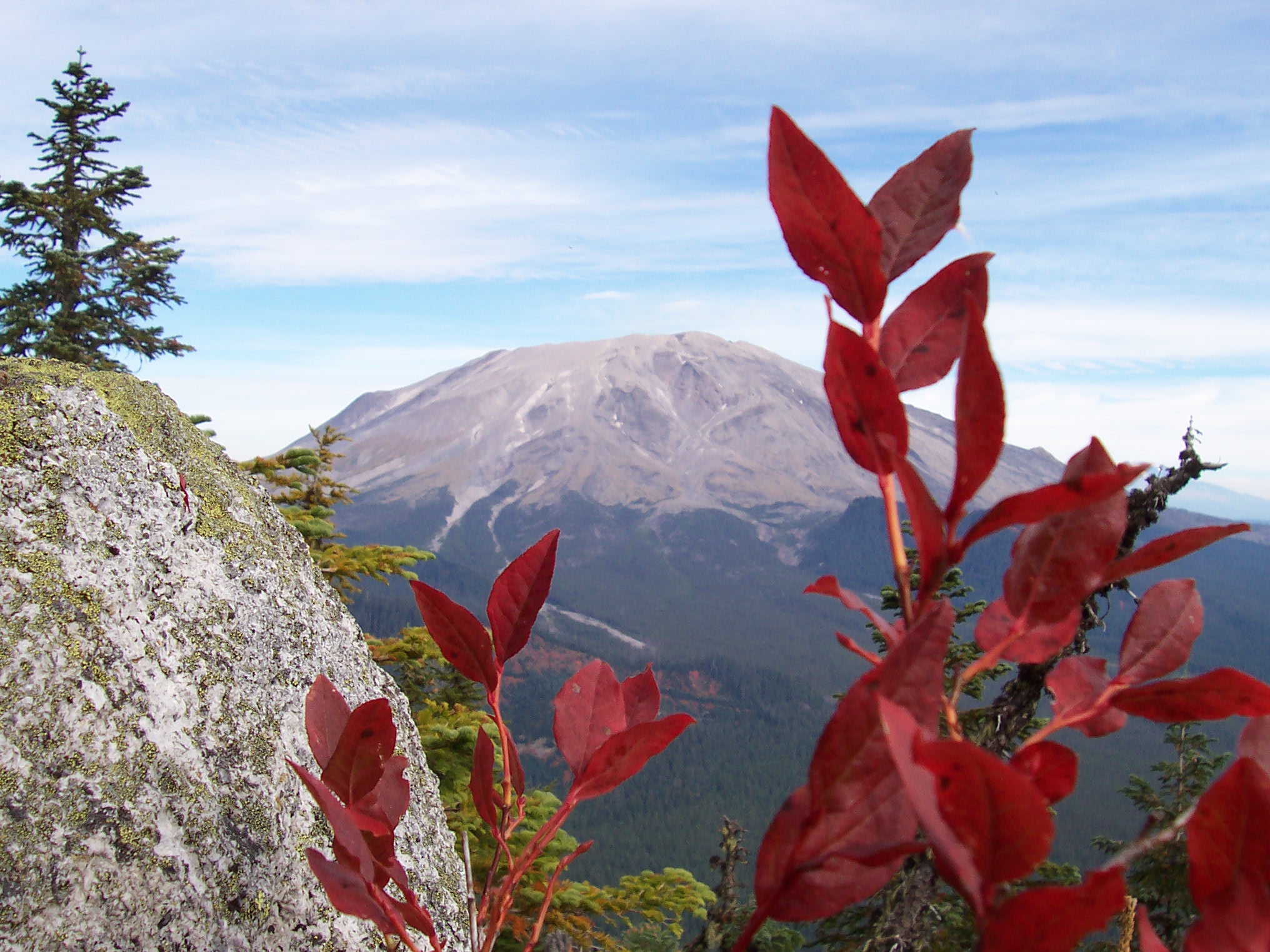
At the 1.5 mile mark, the trail swings left over a small descending spur. The forest now yields to young replanted trees. The break in the mature forest canopy at this point is a great place for a quick break as you have the first full, up-close, view of Goat Mountain. Visible from this small viewpoint, the late summer seasonal change creates a beautiful collage of colors on the southern cliffs of Goat Mountain. In September and October it is a great place to be with a camera.
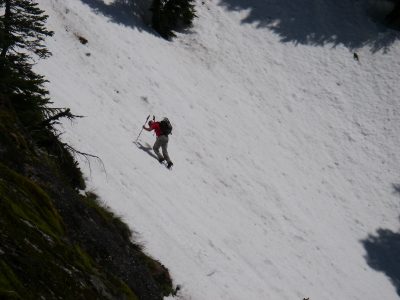
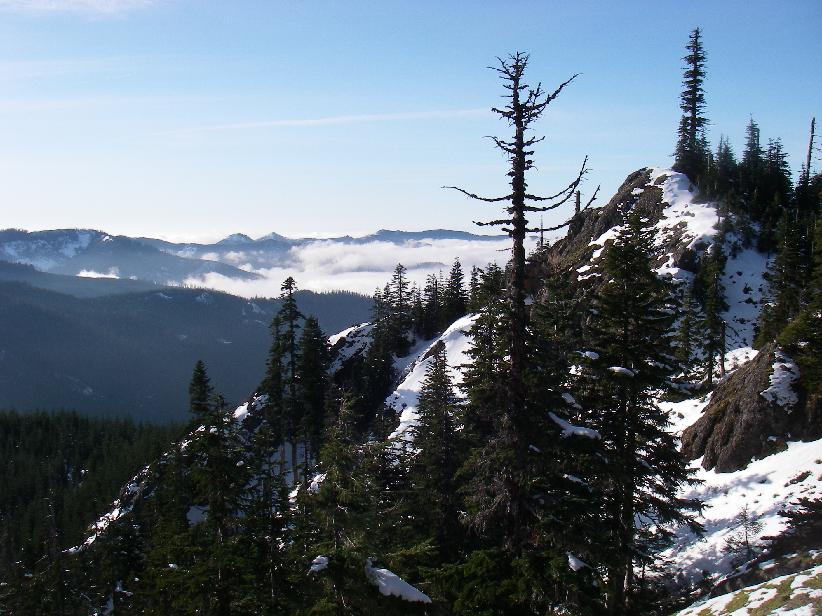
Follow the trail on as it approaches the southern flank of Goat Mountain. Two more switchbacks and the trail gains a small saddle at the southwest corner of the mountain. Here you are two miles from the trail head. The Fossil Creek trail will continue around the west, and then north, sides of Goat Mountain, crossing open gullies and providing views into the timber land west of Mt. St. Helens. Summiting Goat Mountain requires you to find your own path. The trail will cross over a number of ridge spurs descending off the west side of the mountain. Choose one of the gentler, less vegetated ones and begin your ascent.
 Goat Mountain’s summit is actually a series of jagged rock points, each separated from the others. They require a rock scramble to cross between them. Along the way to the top you will struggle up some steep slopes, make your way through dense trees, but also ingest alpine air and gaze on alpine meadow slopes. The reward at the top is worth the work of the climb. Spend some time on the summit, absorbing the 360 degree panorama of local volcanic peaks, the timber land, thriving Goat Marsh, and the raw display of volcanic power. Notice how the lack of a trail or interpretive signs, of facilities or crowds, allows a much richer immersion into our land. If you have a day to spend in the woods, explore Goat Mountain, it is worth the work.

